DRONES FOR PROPERTY
SALES, LETTINGS & ESTATE MANAGEMENT
Property, Land & Estates
CloudVisual partners with leading estate agents, developers, and landowners across the UK, delivering stunning aerial imagery for property marketing, land sales, and development projects.
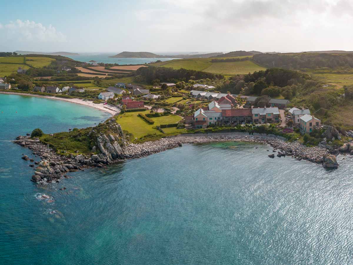
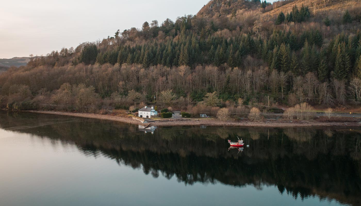
Our cutting-edge drone technology provides ultra-high-resolution aerial photography and cinematic 5K video, offering an immersive experience for potential buyers, landlords, and investors. With drones capable of flying up to 400 feet, we capture expansive landscapes, grand estates, and development plots from perspectives that traditional ground photography simply cannot achieve.
Stay Ahead of the Competition
Exceptional marketing is key to achieving the best results in property sales. Our expert aerial photography helps estate agents, landowners, and developers showcase properties in a way that captivates buyers and enhances the selling experience.
With years of experience working with estate agencies and property developers, we provide the highest-quality imagery to make listings stand out in an increasingly competitive market.
We Know How to Showcase Your Property
Bespoke Aerial Photography & Videography
Our rapid deployment drones and express editing services ensure your property is filmed, edited, and delivered on the same day for a fast turnaround.
Our drone services are perfect for:
- Farms & Agricultural Land
- Luxury Estates & Country Homes
- New Developments & Construction Sites
- Large Land Plots for Sale


Unrivalled Experience in Aerial Property Marketing
With hundreds of properties captured, we understand the nuances of aerial real estate photography. Our expert planning, experience, and attention to detail ensure we consistently deliver outstanding imagery for estate agents, developers, and private sellers.
View the Latest Rate CardUnderstanding Your Requirements
Defining Boundaries with Precision
With our same-day turnaround, we can quickly calculate and overlay property boundaries, making it easier than ever to define land ownership and lot segregation for sales and planning applications.
Our interactive aerial tours allow buyers to explore the property from all angles, with clear boundary lines and detailed land mapping for an immersive experience.
Proud to Work With


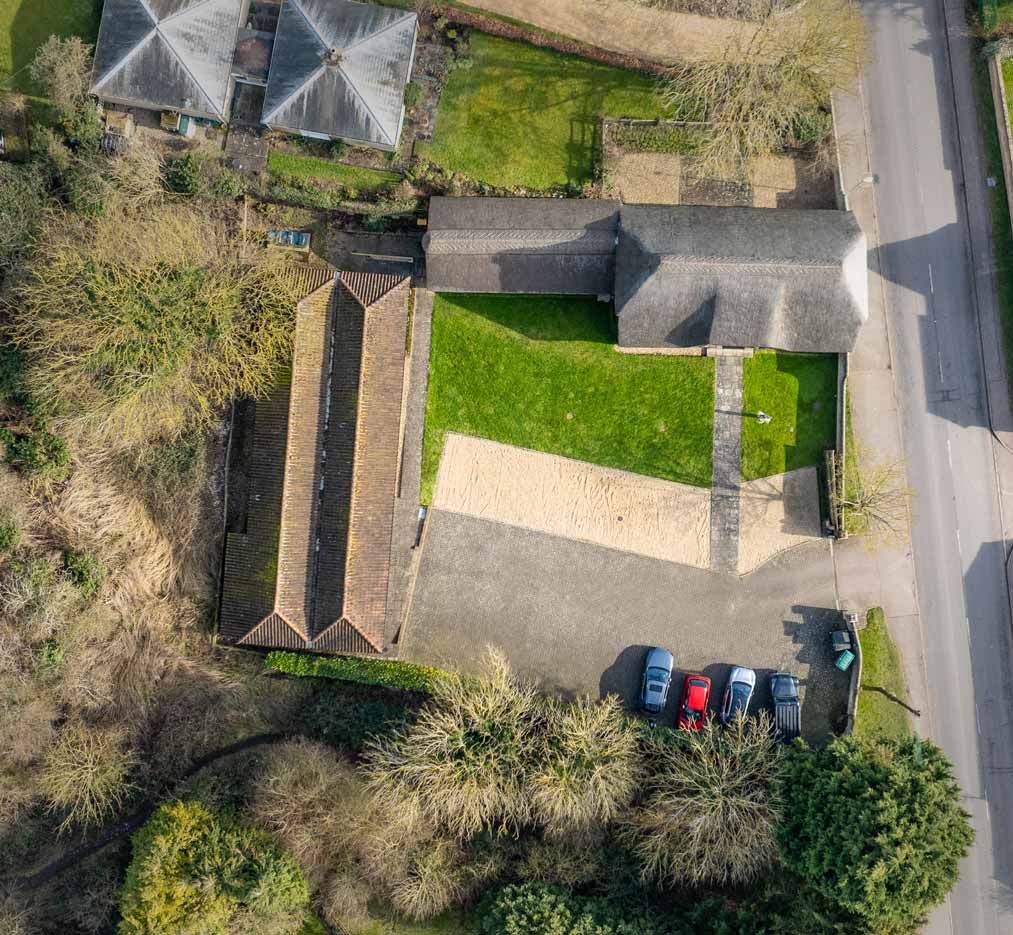
High-Resolution Plan Views
While drone regulations limit flight altitudes to 400ft, our advanced mapping technology allows us to stitch together high-resolution plan views with centimetre-level accuracy.
This ensures an unparalleled level of detail, perfect for estate planning, land development, and property marketing.
Frequently Asked Questions
- Is there a limit to the size of a farm you can capture?
- The largest farm we’ve photographed to date is 25,000 acres, so we’re confident in our ability to cover estates of any size.
- Can you capture additional footage of a nearby town for a media pack?
- Yes, we can provide supplemental footage upon request. Additional costs may apply depending on location and complexity.
- Can you visit multiple properties in one day?
- Yes. For residential properties, we can capture up to six homes per day. For farms, we can typically cover up to 250 acres per site, with a maximum of three farms per day.