DRONE PHOTOGRAMMETRY SERVICES
Drone Photogrammetry Services
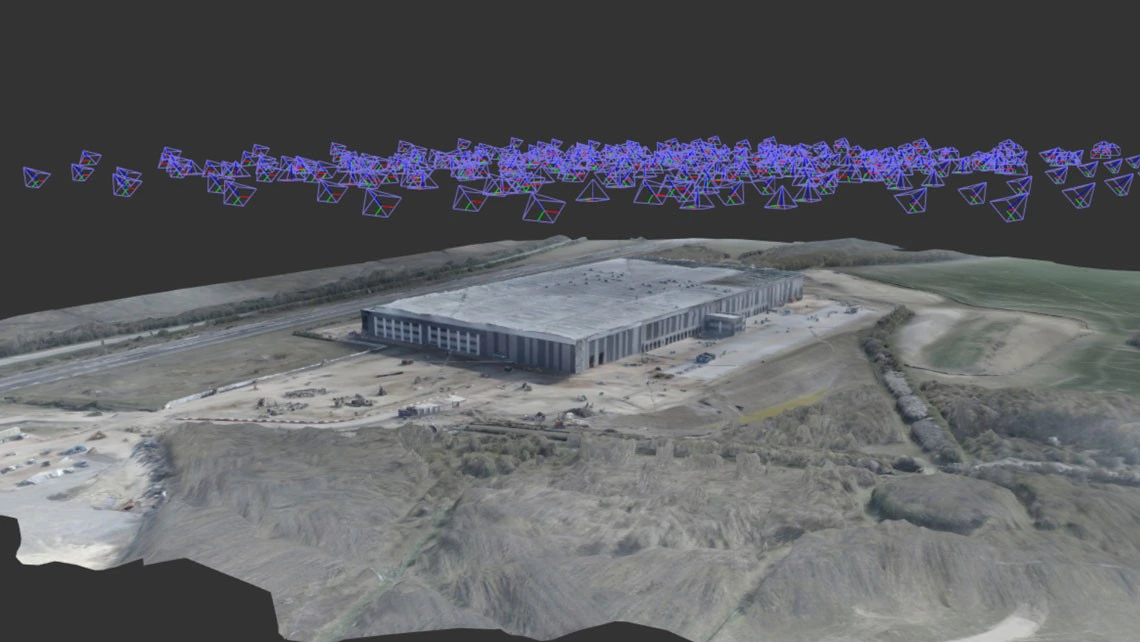
CloudVisual specialises in advanced drone photogrammetry, capturing high-resolution images from multiple angles to create detailed 3D models of landscapes, buildings, and infrastructure. These models are ideal for heritage preservation, construction monitoring, and topographical surveys, providing an interactive and highly accurate representation of any site.
Our photogrammetry services allow clients to visualise and analyse remote locations without the need for physical access. Whether you're providing project updates to stakeholders, creating interactive museum exhibits, or surveying land, our drones deliver highly detailed, scalable 3D reconstructions.
Delivered by Aerometrics
Technical surveying, mapping and inspection work is carried out through Aerometrics - CloudVisual’s dedicated survey division, with specialist pilots, survey-grade sensors and in-house data processing.
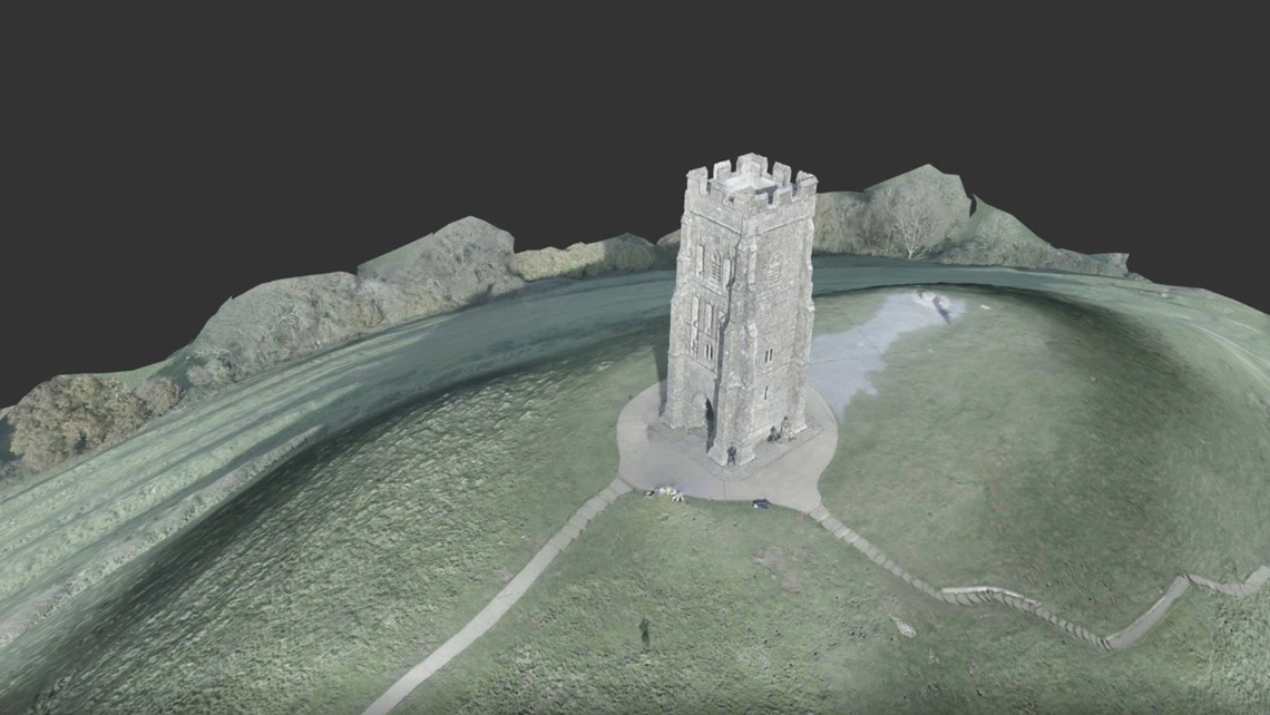
3D Models from Photographs
A fully interactive 3D model can be generated using just 300 high-resolution photographs. These models provide millimetre-accurate detail, making them perfect for surveying, historical preservation, and urban planning.
The final model can be easily shared with surveyors, engineers, and colleagues, ensuring seamless collaboration across teams.
Fast & Accurate Processing
CloudVisual uses cutting-edge photogrammetry software to transform aerial images into highly detailed 3D models. From the first image to a fully processed model, results can be delivered in as little as three hours.
Our state-of-the-art drones capture accurate photogrammetric data, allowing us to deliver actionable insights in record time.
Frequently Asked Questions
- How long does it take to process a 3D model?
- Processing times depend on the size and complexity of the model. Small structures can be completed within 24 hours, while larger projects may take up to 72 hours.
- How can I view my 3D model?
- We can provide your model in industry-standard formats or host it on an interactive 3D viewing platform for easy access and sharing.
- How long does it take to capture the images?
- The time required depends on the size and complexity of the site. Small buildings take approximately 45 minutes, while larger sites may require a full day of image capture.