DRONE SURVEYING
Drone Surveying
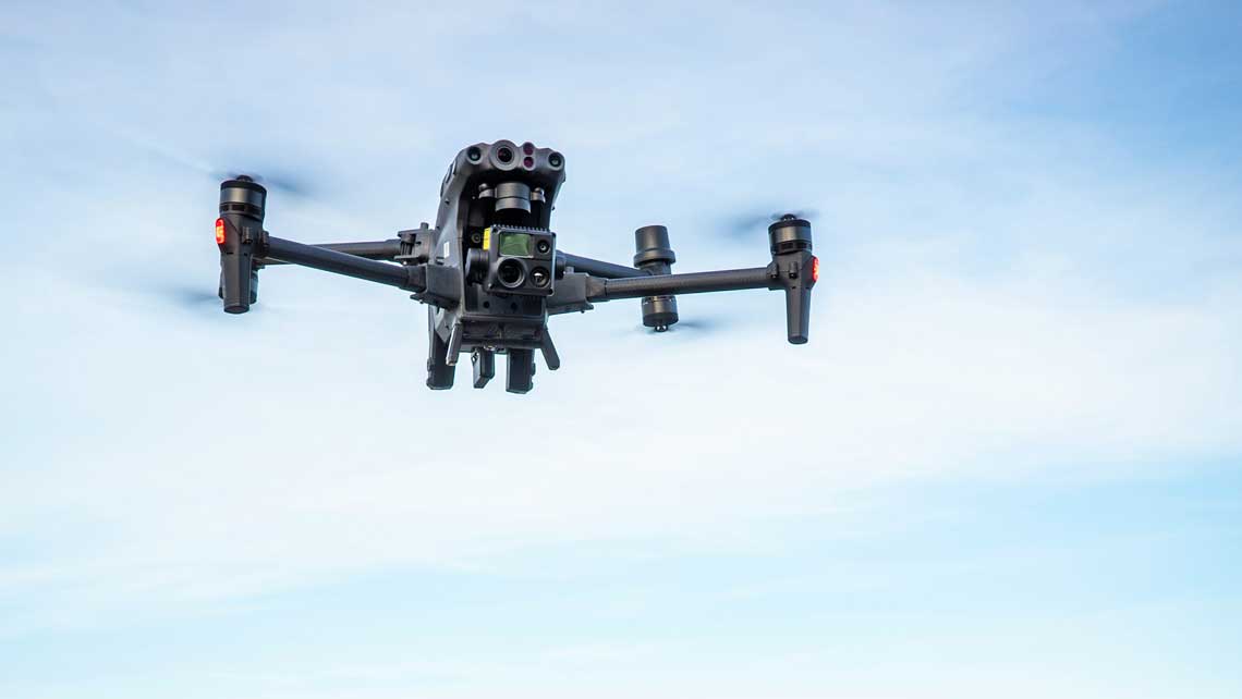
CloudVisual brings advanced drone technology to the forefront of surveying, delivering millimetre-level precision for terrain analysis, volumetric measurements, and cut-and-fill calculations. Equipped with high-resolution cameras and precise GPS capabilities, our drones collect vast amounts of data faster and safer than traditional methods.
By capturing detailed aerial data, we empower surveyors to make informed decisions, optimise workflows, and reduce the need for risky manual inspections. Whether it’s for construction, infrastructure, or land development projects, CloudVisual’s drone surveying services ensure accurate and actionable results.
Accurate Results from Afar
Collaborating closely with your team, our drones survey expansive areas with incredible precision, achieving results accurate to 10mm. By gathering hundreds of thousands of data points in a single flight, we provide a comprehensive view of your site within 72 hours.
Aerial surveying not only enhances accuracy but also improves safety by minimising human exposure to busy or hazardous environments. This innovative approach ensures uninterrupted workflows and greater efficiency on your projects.
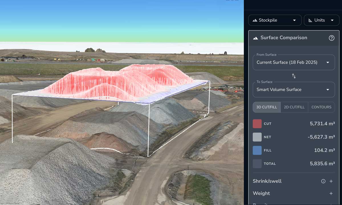
Volumetrics Made Simple
Reliable, Efficient Aerial Data Collection
Drones operate tirelessly, collecting vast amounts of raw data with minimal downtime. Equipped with autonomous systems, our drones pick up exactly where they left off after quick battery changes, ensuring no area is left unsurveyed.
Every image includes detailed metadata, including GPS coordinates and altitude, providing the foundation for highly accurate site models and measurements. This level of reliability eliminates errors and ensures consistent, repeatable results.
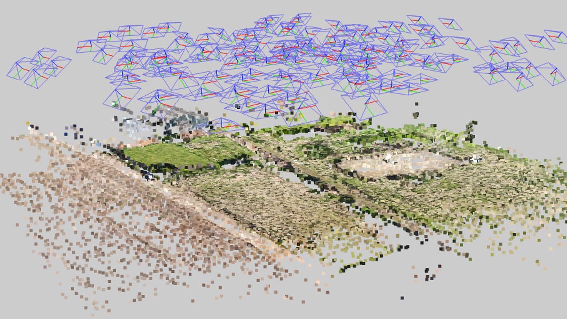
Millions of Accurate Points to Measure Your Project
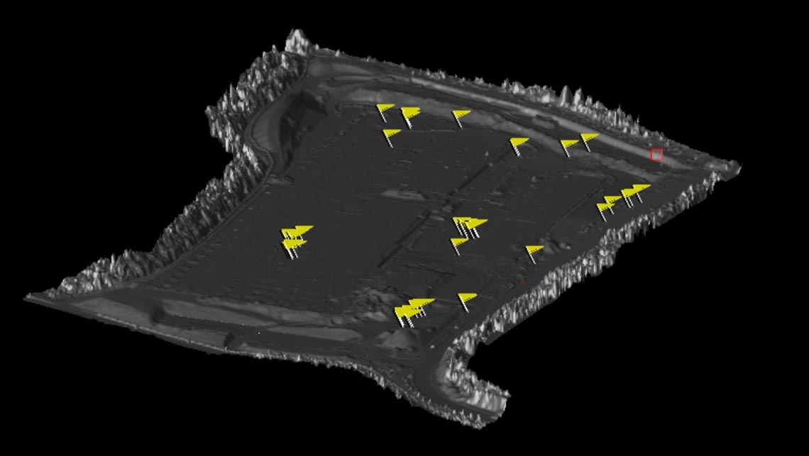
Delivering Data in Your Preferred Format
At CloudVisual, we ensure that the data we deliver seamlessly integrates into your existing systems. Whether you use CAD tools, DWG files, or other industry-standard formats, our output is designed to work with your workflow.
Avoid unnecessary expenses or software changes – we tailor our data to match your requirements, ensuring compatibility and ease of use for your surveyors and project teams.
Frequently Asked Questions
- What accuracy can drone surveys achieve?
- Drone surveys can deliver accuracy as high as 10mm. This makes them ideal for detailed topographic mapping, volumetric calculations, and infrastructure assessments. Precision is ensured by combining high-resolution cameras with advanced GPS technology.
- What types of projects are best suited for drone surveys?
- Drone surveys excel in construction, environmental monitoring, land development, and asset inspections. Their versatility allows for efficient data collection across vast or hard-to-access areas.
- How are survey results delivered?
- Results are provided in industry-standard formats, such as CAD files, orthomosaics, point clouds, and DWG files. This ensures seamless integration with your existing tools and workflows.
- Why choose CloudVisual for drone surveys?
- CloudVisual combines over a decade of experience with cutting-edge technology and a proven safety record. We tailor our services to each client, ensuring accurate and efficient results that meet your project's needs.